Tonquin Valley Hiking Guide for 2023
JUMP TO: PROS & CONS / ITINERARIES / CAMPSITES & HUTS / WHEN TO GO / MAPS / WILDLIFE / WATER & FOOD STORAGE / TRAILHEAD SERVICES
Author: Sam Brilleman
The Tonquin Valley is home to some of the most stunning scenery in all of south-west Canada. Encompassing the dramatic Ramparts mountain range, the gorgeous Amethyst Lakes, and the jaw-dropping Eremite Valley this is one of the most unmissable backcountry hikes in the Canadian Rockies.
The majority of the area can be covered in around 2 to 4 days. Allowing more time will give you the opportunity to explore the area in greater detail, perhaps undertaking side trips into the Eremite Valley or to Moat Lake. Although relatively popular, this area is much quieter than many other multi-day hikes in the Canadian Rockies. So, it is a great option if you want to escape the bigger crowds or if you are struggling to get a reservation on some of the other busier hikes in the area, such as the Skyline Trail or Berg Lake.
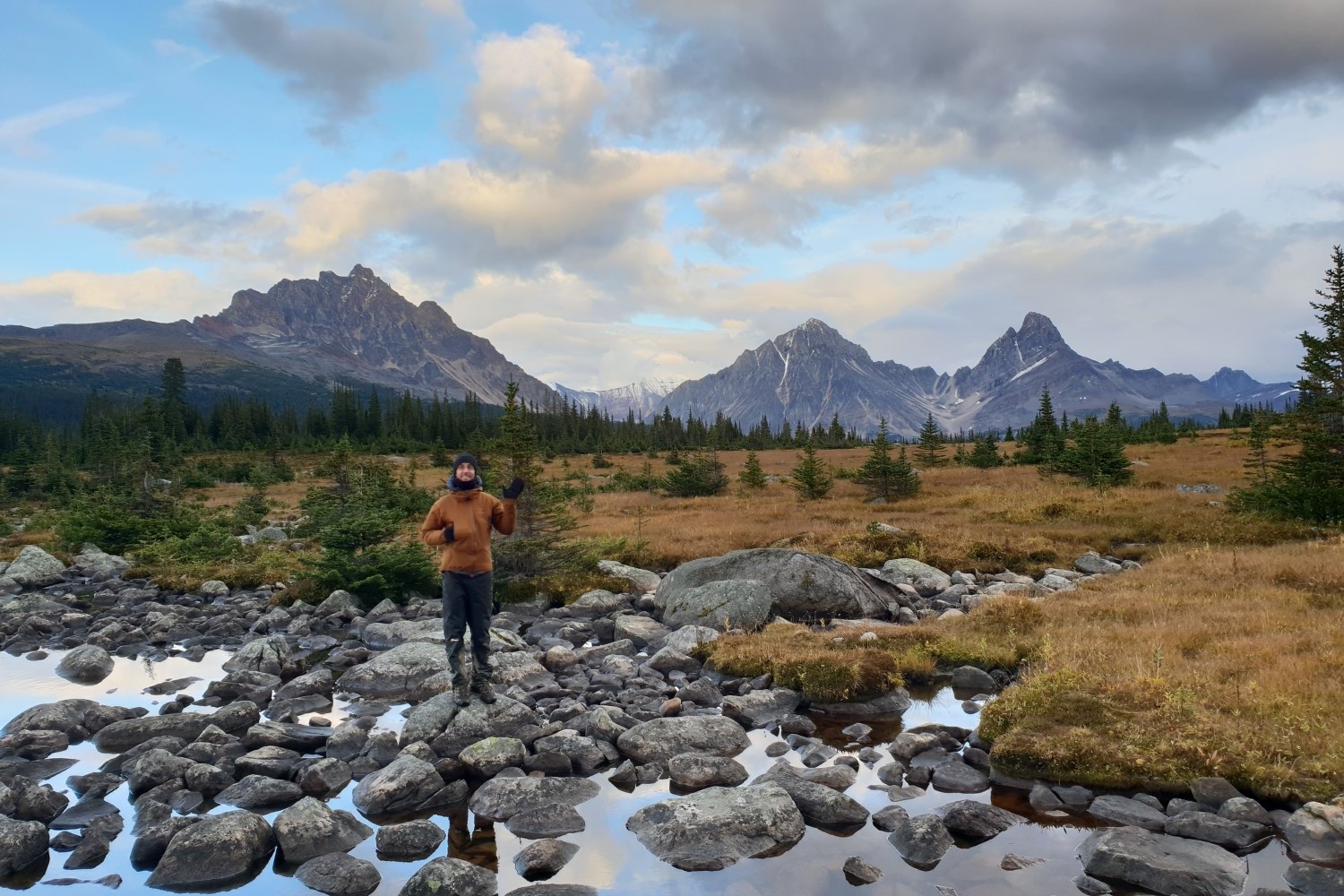
Surprise Point offers dramatic views of the Ramparts Range, towering over the western edge of the Amethyst Lakes.
PROS
Beautiful lakes, dramatic mountains, and stunning alpine valleys
Less tourists compared with other well known hikes in the Canadian Rockies
Several campsites to choose from
CONS
The best campsites can get booked up early
Not a full circuit - requires car shuffle, hitchhiking, or out-and-back hiking
Lots of mud, especially in early summer and/or after rain
Lots of mosquitoes in early summer (June, July, and early August)
Behold, the stunning Eremite Valley is a spectacular place to explore on a half-day hike from Surprise Point.
ITINERARIES
The main Tonquin Valley route is a 27 mile (44 km) relocation hike, taking you from the Astoria Creek Trailhead to the Portal Creek Trailhead, or vice-versa. You can make slight variations on this route depending on which campsites you wish to stay at, and any side trips you wish to undertake.
Since the route is not a full circuit, you will need to arrange transport between the two trailheads at the start or end of your hike or, alternatively, enter and exit your hike at the same trailhead. Either of these is a viable option depending on the time and transport options you have available.
The hike can be completed in either direction, and your choice of trailhead will make little difference to how strenuous or difficult you will find the hike. The Astoria Creek Trailhead may seem preferable for several reasons.
First, your starting elevation is slightly higher at the Astoria Trailhead (compared with Portal Creek) and so this saves you a couple of hundred metres of elevation gain when hiking into the valley.
Second, the Portal Creek is slightly more picturesque (we think) and walking over Maccarib Pass and then down the Portal Creek Valley is a great way to take in those views.
Third, if you plan to hitchhike between trailheads and you want to do this before starting your hike, then parking your car at Portal Creek and hitchhiking up to Astoria Creek Trailhead will offer the least backtracking.
But, in reality, either trailhead provides a reasonable and rewarding access route into the Tonquin Valley.
Map of the trails and campsites in the Tonquin Valley (Source: Parks Canada).
TONQUIN VALLEY TRAIL
LENGTH: 27 miles / 44 km (approx.)
DURATION: 2-3 days
TYPE: One-way
START: Astoria Creek trailhead
FINISH: Portal Creek trailhead
BEST TIME: Mid-August to mid-September
The Tonquin Valley Trail takes you up into the heart of the Tonquin Valley where you will encounter the two stunning Amethyst Lakes.
If you are starting at the Astoria trailhead then, depending on your departure time and fitness levels, we suggest hiking the 12.1 miles (19.4 km) to Surprise Point. This will only be possible if you depart from the trailhead at an early-ish hour, which may or may not be possible, depending on whether you are hitchiking and/or driving to the trailhead.
If you will be departing Astoria trailhead too late in the day to make it to Surprise Point, then consider staying at one of the earlier campsites (Astoria, Switchback, or Clitheroe) and then heading on to Surprise Point the following day.
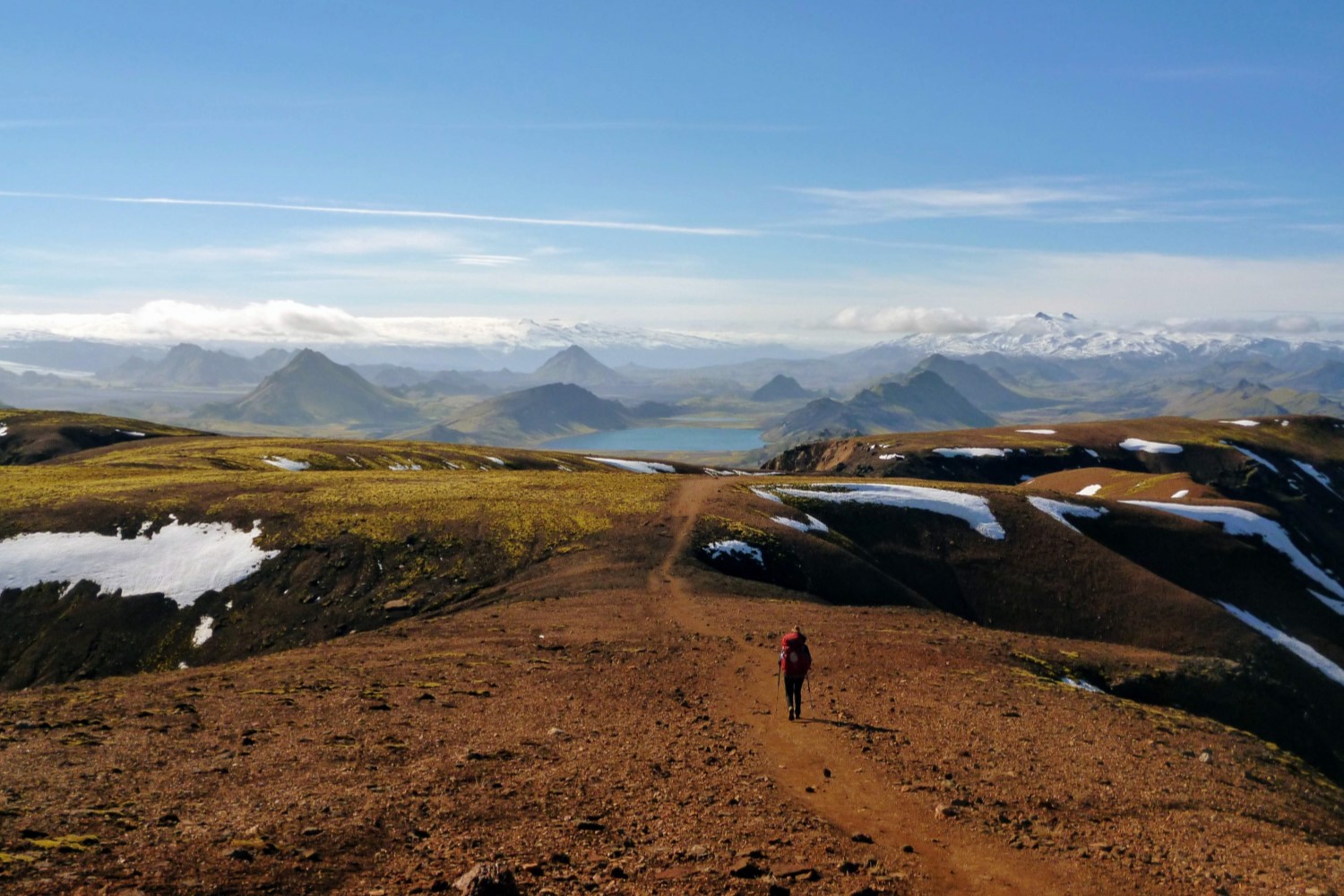
At the base of the Eremite Valley, Surprise Point is - arguably! - the most beautiful campsite on this hike. It provides nice sheltered campsites, but most importantly… it has access to the southern edge of Amethyst Lake from which the views of the Ramparts mountain range are jaw-dropping. On a clear evening, at sunset, be sure to follow the trail past the camping area and down to the lake’s edge for unbeatable photo and meditation opportunities. We were truly captivated by the stunning beauty of this area as seen from the southern edge of Lake Amethyst.
From Surprise Point we suggest heading on to one of either the Amethyst or Maccarib campsites. This will maximise your time in the area around the Amethyst Lakes and the Ramparts range, where the views are the most superb. However, both of these campsites are relatively short distances from Surprise Point (Amethyst - 5.6 km; Maccarib - 9.0 km) so, unless you want a short day on the trail, you will want to consider a side trip in the area. We describe two possible side trips in the section below.
Regardless of whether or not you decide to undertake one of the side trips, staying at either Amethyst or Maccarib campsite will provide another rewarding night in the Tonquin Valley. From either of these campsites, you can then continue on over Maccarib Pass and down the Portal Creek valley. Depending on the distances you wish to cover, you can either spend a final night at Portal campsite or just hike straight out to the Portal Creek trailhead.
SIDE TRIP 1: EREMITE VALLEY
One possible side-trip is exploring the Eremite Valley. For instance, you could consider heading up to Chrome Lake. If you choose this option, then you can leave your heavy pack at Surprise Point and wander up the Eremite Valley with only a light load, then collect your pack before you head on to Amethyst or Maccarib campsites.
SIDE TRIP 2: MOAT LAKE
A second possible side-trip is to visit Moat Lake. Moat Lake sits on the lower part of the Ramparts range. A spur trail heading to Moat Lake can be found heading off the trail between the Amethyst and Maccarib campsites (about 2.5 km north of Amethyst, or 0.9 km south of Maccarib).
The spur trail follows the northern edge of Amethyst Lake, heading past the Tonquin Backcountry Lodge, and then on westward towards Moat Lake at the base of the Ramparts range. The return trip (from the start of the spur trail to Moat Lake and back) will be around 5 miles (8 km).
Beware, the Tonquin Valley Mud, especially in Spring or after rain.
CAMPSITES AND HUTS
CAMPSITES
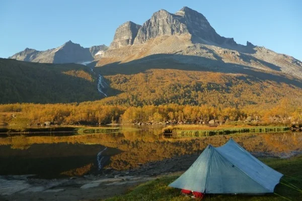
There are seven campsites in the Tonquin Valley. Which campsites you choose to stay at will depend on the distances you wish to hike and availability. Nonetheless - as mentioned above - Surprise Point is our favourite campsite, with it’s stunning views of the Eremite Valley, the Ramparts mountain range, and access to the southern edge of Amethyst Lake.
But all other campsites also have their pros too (e.g. Amethyst also has amazing views of the Ramparts range, Maccarib has glimpses of the mountains through the tree tops, Clitheroe is set deep amongst the pine trees, and Portal is set just above the creek’s edge in a beautiful valley).
The campsites (travelling from Astoria trailhead to Portal Creek trailhead) and distances between them are as follows:
Astoria trailhead to Astoria: 7.1 km
Astoria to Switchback: 6.7 km
Switchback to Clitheroe: 3.4 km
Clitheroe to Surprise Point: 2.2 km
Clitheroe to Amethyst: 3.2 km
Surprise Point to Amethyst: 5.6 km
Amethyst to Maccarib: 3.4 km
Maccarib to Portal: 9.9 km
Portal to Portal Creek trailhead: 10.2 km
Campsite reservations can be made via the Parks Canada Online Reservation Service. Note that campsites must be reserved in advance, before you start your hike, and that “free camping” (i.e. camping outside of the allocated campsites) is not allowed. It is worth booking well in advance, since the area can be popular in the peak season and the best sites are likely to fill up early.
HUTS
It is worth mentioning that there are also several huts in the Tonquin Valley. Two of these are owned by private outfitters who take paying clients in on horseback (rest assured there is plenty of evidence of such activities; that is, you will see no shortage of horse shit on your hike through the valley). The third hut is a hut in the Eremite valley owned by the Alpine Club of Canada (ACC) and popular with mountaineers climbing the Ramparts.
All three huts can provide accommodation to hikers if bookings are made in advance. Details for the three huts are as follows:
Tonquin Valley Backcountry Lodge, on the northern edge of Amethyst Lake, offers relative luxury and a price to match. At the time of writing (10/30/2018) a hiker’s package - which includes accommodation and all meals - costs CA$325 per person/night and requires a two night minimum stay. But for that price you’ll get to take a canoe out on the lake, or even have a shower in summer!
Tonquin Valley Adventures have a lodge near the south-eastern end of Amethyst Lake and provide slightly more basic lodgings for about CA$85 per person/night (if you are only after accommodation and have a minimum of four people). They also offer guided hiking trips.
The Wates-Gibson Hut, on the northern shore of Outpost Lake, is owned by the Alpine Club of Canada (ACC) and provides basic lodging. If you are not a member of the ACC, then you can only make a reservation for the hut up to 30 days in advance. At the time of writing (10/30/2018) an overnight stay will set you back CA$30 per person/night. The hut has a propane stove for cooking (propane is supplied) and mattresses, but you will need to bring your own food and bedding (e.g. a sleeping bag).
Bathroom with a view: one of the common luxuries when staying with parks canada.
WHEN TO GO
The Tonquin Valley is a high alpine region, covered in snow during winter. Hence, if hiking is your main undertaking, you will need to head there during the summer season. However, in early summer the area is wet underfoot due to the recent snow-melt, and this has two knock-on effects that you likely want to avoid: mud and mosquitoes.
The mud can get bad in the Tonquin Valley, and it is worst in the early parts of summer. Similarly, the excess moisture and increasing warmth leads to a influx of mosquitoes. And they can be relentless. If you are heading into the Tonquin Valley in June, July, or early August, then be prepared for both. Be sure to prepare for mud by wearing lightweight trail runners and having a spare pair of camp shoes (e.g. sandals) or — if your preference is the other extreme — wearing waterproof gore-text boots and waterproof gaiters. In addition, be sure to pack a bug-proof long sleeved shirt, long pants, a head net, and bug spray.
From late-August and into September there are generally no mosquitoes left, and the Tonquin Valley can be a far more peaceful place because of it. Late-August or early-September is a beautiful time to visit the Tonquin Valley. Nonetheless, be aware that temperatures can begin to drop by early September, so pack accordingly. Be prepared for cold overnight temps (e.g. near freezing) and potentially even snow (although snow can happen any time of year in the Canadian Rockies!).
Note also that the road to the Astoria Creek trailhead is only open to vehicles from mid-June to mid-October. So, if you plan to head into the Tonquin Valley during winter (for cross country skiing or snowshoeing) you will have to gain access via the Portal Creek trailhead.
MAPS
National Geographic publish a 1:100,000 topographic waterproof map of the northern part of Jasper National Park. This includes the Tonquin Valley as well as a number of surrounding areas (e.g. the Berg Lake trail, Jasper town, Miette Hot Springs). If you don’t plan to purchase the map ahead of time, then it is available from all national park offices in the area, including the Jasper Information Centre.
WILDLIFE
Jasper National Park is home to both grizzlies and black bears. Making noise while hiking is your best defence against a surprise encounter. It is wise to carry bear spray and have it easily accessible just in case (although such encounters are rare!).
Bear-proof storage lockers are available at all campsites. Be sure to use them. Store all food and scented items (e.g. toiletries) in the lockers overnight to avoid bear-human interactions. In addition, there is a designated cooking area in each campsite — located away from the sleeping area — that you should use instead of cooking near your tent.
From early-September through mid-October, you want to be wary of any lone elk or moose you encounter. During this period these animals are in rut and the males can be particularly aggressive. Outside of the rut season any elk or moose you encounter are likely to be far less dangerous — but still unpredictable — so watch for signs of aggressive behaviour and keep a safe distance.
Jasper National Park is home to bears, moose, elk, caribou, mule deer, white-tailed deer, coyotes, marmots, squirrels, and more. Unfortunately, many of these animals are seeing a decline in their population. Nonetheless, wildlife encounters are still relatively common and wildlife spotting is one of the best reasons to visit the Tonquin Valley. Always keep your distance from any wildlife and never feed or approach them.
WATER & FOOD STORAGE
There are plenty of water sources in the area, so you will not need to carry more than half a day’s water at any one time. All campsites have access to a stream or river nearby where you can access water.
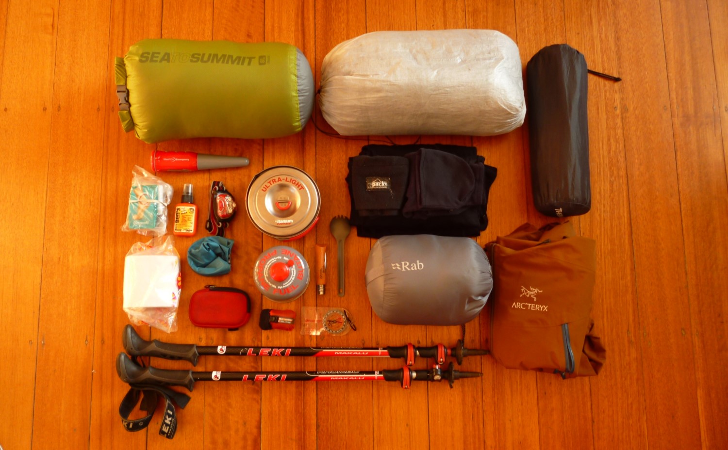
Be sure to carry some form of water treatment, as there is wildlife in the area and packhorses that frequent the trail. We choose to use the SteriPEN Adventurer Opti, since it is lightweight and allows us to carry spare batteries if we need. But the USB-rechargeable SteriPEN Ultra is also another good lightweight choice. Or if you prefer a water filter system, then the Sawyer Squeeze is a great lightweight option.
As mentioned in the “Wildlife” section above, Jasper National Park is home to both grizzly and black bears. All campsites in the Tonquin Valley have bear-proof storage lockers for storing all food and scented items overnight. Be sure to use them.
Water is plentiful in the Tonquin Valley.
TRAILHEAD SERVICES
PORTAL CREEK TRAILHEAD
There are no services at the Portal Creek trailhead. You will need to purchase all your supplies before heading to the trailhead. The nearest town for supplies is Jasper, AB, which is 11 miles / 17 km (~20 minutes drive) from the trailhead. The road to Portal Creek trailhead is open all year round.
ASTORIA TRAILHEAD
At the Astoria Creek trailhead there is a small hostel, owned and run by Hostelling International (HI). The HI HI Mount Edith Cavell Wilderness Hostel consists of two basic dorm-style cabins each sleeping 16 people. The cabins have no electricity or running water. Reservations must be made in advance.
Aside from this basic accommodation, there are no other services at the Astoria Creek trailhead. You will need to purchase all your supplies before heading to the trailhead. The nearest town for supplies is Jasper, AB, which is 16 miles / 26 km (~45 minutes drive) from the trailhead.
JASPER
Jasper is a relatively bustling tourist town with supermarkets, cafes, restaurants, accommodation, laundromat, and more. You should be able to find all supplies you need for your hike.
Jasper also has a number of outdoor stores, so you can make last minute gear purchases if you need to, including things like cooking gas canisters or bear spray.
And of course it provides a great base for exploring other hikes in Jasper National Park.
MORE INFORMATION
If you loved this destination guide, then you'll likely love reading about our other inspiring hiking destinations:
Happy hiking, and take care out there in the wild!

Keen To Browse Outdoor Kit?
Check out our Gear Reviews overview page. Or focus in on one of these awesome review sections:
Ready To Start Building Your Dream Kit List?
In our Ultimate Gear Lists section we provide a list of best-in-class items for specific outdoor adventures. Get inspired by checking out our:
Gagging To Get To The Outdoors?
Find a jaw-dropping location for your next wilderness adventure by checking out our epic Destination Guides! How about: